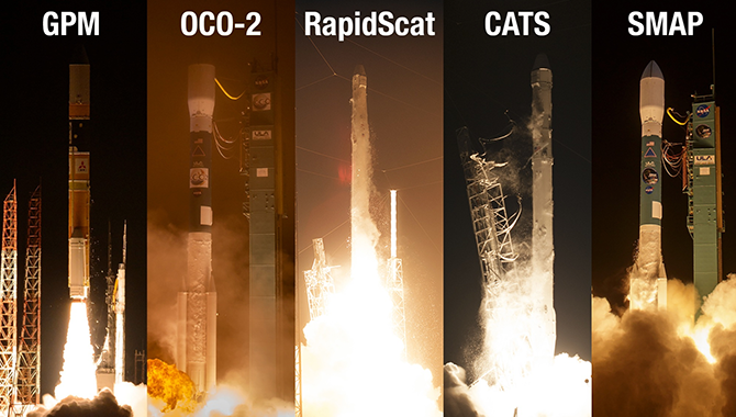
In the past year, NASA has launched five new Earth science missions designed to examine the effects of planetary climate change.
Photo Credit: NASA
To help scientists better understand and address planetary climate change, NASA’s Earth-observing fleet has grown by 25% in the past year.
Between February 2014 and January 2015, the agency launched five new Earth-observing missions, making it the busiest launch cycle for NASA Earth Science in more than a decade. Together, the missions will offer unprecedented insight into global measures of rain and snowfall, carbon dioxide (CO2), ocean winds, and small airborne particles known as aerosols.
“The highly accurate measurements from these new missions will help scientists around the world tackle some of the biggest questions about how our planet is changing,” said Peg Luce, deputy director of NASA’s Earth Science Division.
The first of these missions to launch was the Global Precipitation Measurement (GPM) core observatory, a joint NASA-Japanese Aerospace Exploration Agency (JAXA) initiative. GPM is designed to map global rainfall and snowfall, providing near real-time observations across the planet every three hours. The GPM core observatory works in conjunction with 12 international satellites, integrating their data to provide the most comprehensive information available on worldwide precipitation.
“The GPM core observatory acts as a tuner to bring together these measurements, providing a nearly global picture of rain and snow called the Integrated Multi-satellitE Retrievals for GPM, or IMERG,” said Gail Skofronick-Jackson, GPM project scientist. The observatory leverages advanced instruments including radar from Japan and a passive instrument from NASA, which together show the internal characteristics of clouds and precipitation. Data from GPM is available free to scientists around the world, and will help them better understand climate change and the global water cycle, enhancing efforts to forecast weather and address extreme weather events.
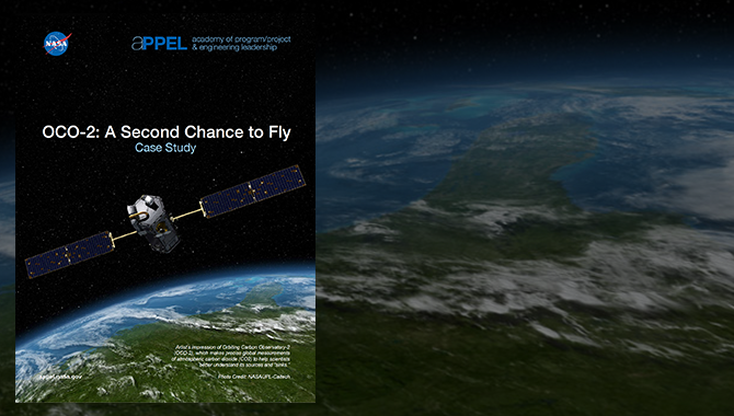
The Orbiting Carbon Observatory-2 (OCO-2) is another free-flying Earth-observing mission. Launched in July 2014, OCO-2 examines global CO2 sources and “sinks”: places such as oceans and forests where the greenhouse gas is removed from the atmosphere. CO2 is a key contributor to climate change.
“Why are we so interested in identifying sinks of CO2?” asked OCO-2 project manager Ralph Basilio. “We want to be able to analyze what happens to these sinks from season to season and from year to year because we know that there will be changes. What’s going to happen to these sinks over time? Will these sinks become saturated? Will that mean that more CO2 remains in the atmosphere? Will that mean that CO2 is going to have a greater effect on the global climate change process? These are some of the very fundamental questions that we want to be able to answer during the course of the OCO-2 mission.”
Two of the recently launched Earth-observing missions are scientific instruments deployed on the International Space Station (ISS): the ISS-RapidScat and the Cloud Aerosol Transport System (CATS).
RapidScat is a scatterometer that measures the speeds and patterns of ocean winds. Launched in September 2014, its findings are already contributing to international weather forecasts. But Brian Stiles, science data processing lead on RapidScat, explained that the mission’s value goes beyond the immediate weather. “The utility for climate research is effectively that we’re looking at the interface between two climate models. There are researchers that model the atmosphere, and there’s another discipline where they model the ocean. The data that we’re collecting is important for both. It has a crucial place in the process: the interface between the ocean and the atmosphere that is needed to model the global climate.”
The CATS mission utilizes LiDAR, a laser-based remote sensor, to measure clouds and tiny airbone particles in Earth’s atmosphere. “These clouds and particles are important because they can have significant impacts on climate, on air quality, and human health, and it’s important for monitoring of natural hazard events,” said CATS principal scientist Matthew McGill.
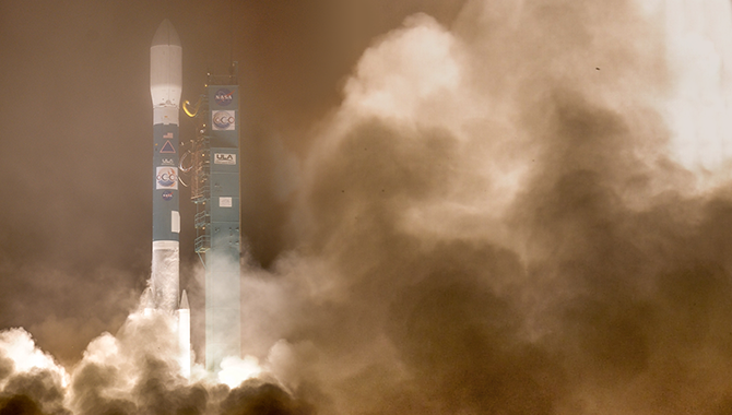
The newest of the five missions, Soil Moisture Active Passive (SMAP), was launched on January 31, 2015. SMAP was conceived to identify and measure global soil moisture, contributing to a greater understanding of Earth’s water, carbon, and energy cycles. Findings from the mission are expected to improve weather forecasting, drought monitoring, flood prediction, and crop productivity. While still in its check-out phase, SMAP will eventually map the entire planet’s soil moisture every two to three days. The mission is scheduled to begin returning data in April 2015.
NASA and scientists around the world will use the findings from all five missions to look across the cycles of water, atmospheric, and carbon activity, and attempt to see their interactions and impacts on the planet.
“What the view from space has given us is an ability to see the entire globe in multiple dimensions and multiple ways. It’s completely transformed our understanding of the Earth,” said Luce. “We’re really looking forward to the contributions that these new missions will make to science and to life on Earth.”
The GPM and CATS missions are run by Goddard Space Flight Center. OCO-2, ISS-RapidScat, and SMAP are managed by the Jet Propulsion Laboratory.
Learn more about NASA’s Earth science program.


