


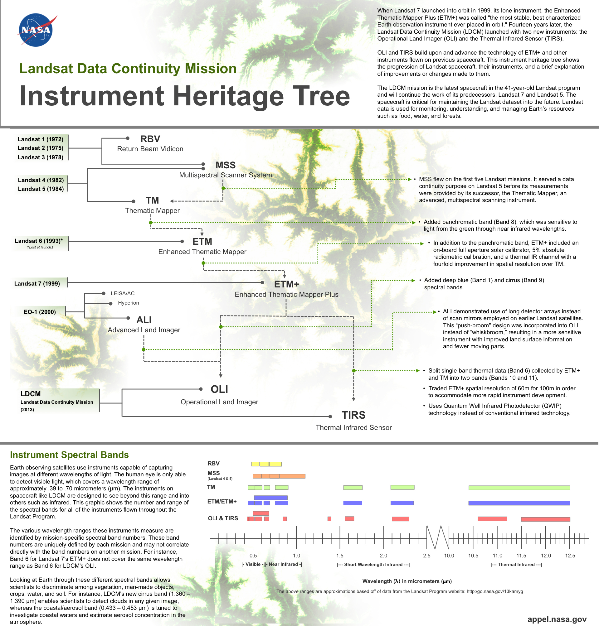
NASA’s Landsat Data Continuity Mission’s two instruments come from a line of cutting-edge technologies.
On Tuesday, February 12, 2013, the Landsat Data Continuity Mission (LDCM) launched into orbit. With it, the spacecraft carried two instruments: the Operational Land Imager (OLI) and the Thermal Infrared Sensor (TIRS). The LDCM mission is the latest spacecraft in the 41-year-old Landsat program and will continue the work of its predecessors, Landsat 7, which launched in 1999, and Landsat 5, which launched in 1993. The spacecraft is critical to monitoring, understanding, and managing Earth’s resources such as food, water, and forests.
Originally, LDCM was to only carry one instrument, OLI. However, the importance of having an instrument capable of providing water resource managers with measurements of Earth’s thermal energy for water management served as the impetus for adding TIRS. (Read more about what each spectral band maps.)
TIRS is different from previous thermal imagers. It uses Quantum Well Infrared Photodetector (QWIP) technology to view the thermal infrared wavelengths of light. Developed at Goddard Space Flight Center, QWIPs are a new technology that serves as a low-cost alternative to conventional infrared technology. (Read more about the QWIPs innovation story.)
OLI builds off sensor technology flown on the EO-1 satellite. It has two new spectral channels, deep blue for coastal and aerosol studies and cirrus for cirrus cloud detection, which were added in response to a request by the Landsat user community.
Both instruments use a push-broom technology rather than the more conventional whiskbroom approach seen on previous Landsat satellites. A push-broom approach uses a line of sensors arranged perpendicular to the satellite’s direction of flight, imaging multiple areas of Earth’s surface concurrently. A whiskbroom approach employs a single mirror scanning across the satellite’s path, reflecting light to a detector, which collects data one pixel at a time. The push-broom approach is mechanically simpler than whiskbroom as it has fewer moving parts and is less prone to wearing out. (View animations demonstrating each approach.)
While operating independently, the two instruments will capture and relay high-quality images of Earth becoming of the Landsat program.
Click below to view the infographic below to see the lines of instrument heritage that led to the development of the OLI and TIRS instruments.
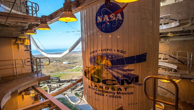
The United Launch Alliance (ULA) Atlas V rocket with the Landsat Data Continuity Mission (LDCM) spacecraft onboard is seen on Sunday, Feb. 10, 2013 at Vandenberg Air Force Base, Calif.
Featured Photo Credit: NASA/Bill Ingalls