


The Nature Conservancy’s Kim Hall discusses the use of NASA Earth observation data to map animal movement and patterns.
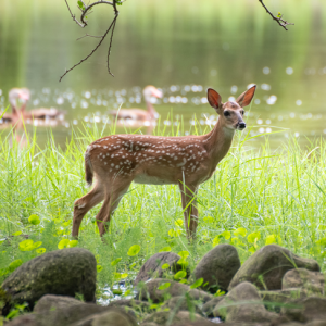
In the face of growing environmental pressures, changing climates, and ecological damage, scientists say that organisms around the globe have been forced to move from their historic ranges to find more suitable habitats. Specialized, open-source software tools Omniscape and Circuitscape input diverse climate, physical and ecological variables from NASA Earth observation data to map the complex routes animals take to traverse the landscape under current and possible future conditions. The software leverages circuit theory to map animals’ changing movements like electricity moving across a circuit board.
In this episode of Small Steps, Giant Leaps, you’ll learn about:
- How circuit theory applies to conservation science
- Why NASA Earth observation data sets are essential for connectivity modeling
- What the future impact of circuit theory and related software tools and applications could be on the field of conservation
Related Resources
Video: Ecological Forecasting Project: Applying Circuit Theory to Animal Movement
Circuitscape: Conservationists Take a Cue from Computer Scientists
NASA Software Maps Changes in Current and Future Animal Movements
Improving Animal Connectivity and Conservation Strategy
Ecological Forecasting: Strengthening Ecosystems
Circuit Theory Applications to Connectivity Science and Conservation
APPEL Courses:
Leading Complex Projects (APPEL-vLCP)
Introduction to Software Engineering (APPEL-vISWE)
Introduction to Green Engineering (APPEL-GREEN)
Creativity and Innovation (APPEL-vC&I)
Kim Hall
Credit: The Nature Conservancy
Kim Hall is a Climate Change Ecologist on The Nature Conservancy’s North America Science team, a NASA-funded Principal Investigator, and an Adjunct Assistant Professor at Michigan State University. Hall’s work focuses on developing and communicating data and tools for informing land protection and restoration decisions that explicitly address climate change risks. With support from NASA’s Earth Science Applications Ecological Forecasting Program, she led a team that updated the Omniscape and Circuitscape software tools. The project emphasized the role of high-performance computing in helping to move conservation forward, with the goal of improving the speed of connectivity assessments so that analysts can increase stakeholder engagement and sensitivity testing, and more readily incorporate NASA Earth Observation datasets. Prior to joining The Nature Conservancy in 2008, Hall conducted research to understand connections between forest conditions and habitat quality for migratory songbirds in Great Lakes region forests. She has a bachelor’s in biology from Dartmouth College and a master’s and doctorate in conservation biology from the University of Michigan.
Transcript
Kim Hall: We basically are taking a lot of different datasets and integrating them together to really characterize what that landscape looks like for a moving animal.
It’s gone from being able to look at animal movement from the conservation perspective of where do you design corridors or where do you invest in restoration to look at other processes that link to animal movement.
Host: Welcome to Small Steps, Giant Leaps, a NASA APPEL Knowledge Services podcast where we tap into project experiences to share best practices, lessons learned and novel ideas.
I’m Deana Nunley.
Software using diverse climate, physical and ecological variables from NASA Earth observation data is helping to map how animals move and how those patterns change. Kim Hall is a Climate Change Ecologist on The Nature Conservancy’s North America Science Team. She served as Principal Investigator on the NASA Applied Sciences Program’s Ecological Forecasting Project that focused on applying circuit theory to animal movement. And she joins us now.
Kim, thank you for chatting with us on the podcast.
Hall: Oh, thanks for having me. I’m excited to be here.
Host: What are the primary objectives of mapping how landscapes influence animal movement?
Hall: So, our primary interest at The Nature Conservancy and understanding development patterns on landscapes and how those influence animal movement is that once we understand how those patterns interact, we can direct our attention to land protection and land restoration that helps sustain those animal movement patterns. And the reason that we really care about making sure that animals can still move is that movement is a key part of animal life histories. Animals need to be able to move to find food and to find other groups of animals of the same type. And they also, especially under climate change, need to be able to move to get to habitats that are suitable, and those locations of habitats that may be suitable may be changing as temperatures increase and precipitation patterns change.
Host: How is the Ecological Forecasting Project using NASA Earth observation data?
Hall: Well, our focal application for that grant program involved mapping landscape connectivity for the United States to inform land protection. The Nature Conservancy has developed an approach which we call the Resilient and Connected Network that integrates information basically to tell us where on the landscape you have the most variability in microclimates, and that’s basically an assessment that looks at the topography of sites to say, ‘Where do you have the most diversity in topography?’ And that in turn helps us understand where you might have cool microsites and warm microsites that can give animals that are shifting in response to climate change some local options. So that’s piece one.
The second piece is an integration of thinking about connectivity, that’s the topic of a lot of the work we did on this project, and we’re looking for places that are both locally connected and connected at much larger scales.
And then the third piece of that work looks at where we know we have high biodiversity still remaining in the U.S. and integrates that into the same mapping tool. And when we pull all of these pieces together, we can help land protection specialists like folks that work at land trusts like The Nature Conservancy see where their investment is likely to have the highest value now and in the future as our climate continues to promote shifts in where species are. So that connectivity piece is really essential if you want to think about a network of land protection areas that work now and also work into the future.
Host: And you talked about that being essential. Now, why are the NASA Earth observation datasets essential for connectivity modeling?
Hall: So, the NASA datasets, I mean, there’s so many of them that we use in these processes of basically understanding topography and the pattern of ecological systems and agriculture and cities and roads that are on the landscape. We basically are taking a lot of different datasets and integrating them together to really characterize what that landscape looks like for a moving animal. So, we can use datasets like the night lights to understand where we’ve got development in what otherwise might look like a highly natural area based on land cover maps, for example. We can look at things like the fire scar data to understand how recent fires might be changing landscape connectivity if you have a species, for example, that focuses on intact forests and will avoid those fire scar areas.
There’s just lots of different ways that NASA data help us understand these really broad scale patterns. And an important piece of that is often we’re really interested in change over time or change across the seasons, and so when you have NASA data that can give you that long term perspective, it helps us understand how things may have been in the past and how they are now and how species may be responding.
Host: Kim, could you explain the concept of circuit theory and how it applies to conservation science?
Hall: Sure, I’d be happy to. So, circuit theory is a body of science that comes from electrical engineering and I will put this really generally because I am in no way an electrical engineer. The idea here is that you have a system where current is being injected into the system and that is coming in through sources. Current then will flow to grounds and between the sources and grounds you have a network of resistances. And so these resistors or resistances influence how effectively that current can flow from the sources to the grounds. And the really innovative piece of the software that we’ve worked on was developed by my colleague Dr. Brad McRae. And he basically came from a background in electrical engineering and moved into conservation and brought those ideas from electrical engineering into the conservation field.
And the gap that his work is filling helps us incorporate the incredible diversity that you can see when you look at different landscapes and helps us integrate all of the different factors that influence the usefulness, I guess, of that landscape, or different elements of that landscape, as animal movement corridors. So, if you think about roads as one potential barrier for moving species and then buildings and urban areas and then just places where you have oil and gas development or other things like that, all of these different pieces can influence animal movement in different ways. So, if you can imagine basically a landscape divided up into tiny little squares with every different kind of land cover represented as a resistance, you can then run current across that landscape and see where it goes. And what it’s going to do is it’s going to try to find the places of lowest resistance.
So, if you have basically scored your natural areas as having low resistances, so maybe those are your forests and your wetlands and your streams, and then you score roads as having a higher resistance, you score a big city and parking lots as having very high resistance — agriculture maybe somewhere in the middle — again, you can then run this current across the landscape and see where it flows. And, ideally, from a conservation perspective, we’re trying to make sure that current can still make it all the way across the landscape and that you’ve got multiple pathways through which animals can move and still do all the things they need to do, find food, do seasonal migration, shift in response to climate change. And the ideas and math and insights that you can gain from that really help us think differently and help us think more proactively about how we can invest in conservation to keep that current flowing across the landscape. And, again, current representing some kind of animal movement.
Host: What are the software tools you use for this?
Hall: Brad’s original piece of software that he developed to characterize these patterns of current flow across landscapes is called Circuitscape. And the idea behind that piece of software is that he was basically responding to previous work in the field of landscape conservation where one of the challenges we have is a lot of times we’re talking about, how do we sustain biodiversity within protected areas like national parks, realizing that if you have an isolated nature reserve, over time, you’re going to lose species if there’s no pathway for individuals to come in and out of that nature preserve. And so folks in the conservation fields were basically trying to figure out, what’s the most effective way to keep those different natural areas protected and link them together with corridors? And, at the same time, the field of landscape ecology was really starting to recognize the importance of all of the parts of the landscape that are outside of those protected areas and how you don’t want to think about that entire rest of the world as one uniform surface or one uniform type of system.
There’s lots of variety, again, depending on where the roads are and where the oil and gas development is and where the people are. And also the idea of only having one connection between protected areas just seems really risky. You want to try to figure out ways to have more of a network system, have more redundancy in the network of pathways that connect those really important areas for biodiversity. So, Circuitscape basically allows you to input a spatial dataset that represent your network and then understand how this current, that’s the unit that the model produces again based on the electrical circuit theory mathematics that underlie the tool itself, it gives you a map, and I really wish I could show you a picture. That’s hard to do on a podcast. It shows you how the current can flow between those different nodes in the network.
And then we have a second piece of software that’s called Omniscape that takes the Circuitscape idea to a next level in that it removes this constraint of having to identify individual patches to connect. So, it’s basically allowing you to run current across an entire landscape and just, again, see where that current flows. And just to remind you what’s happening here, you’ve got an input surface representing the landscape. This is where we’re taking a lot of those NASA datasets to help us understand what’s on the landscape and what’s the condition of forests, for example, what’s the real spatial pattern of where that stream goes and which wetlands are wet at this time of year, if that’s an important thing for a particular species. It can allow us to really get very detailed descriptions of the landscape. We then work with experts that understand what factors influence a particular species, if we’re working on a species-specific model, and score that landscape by translating those ecological values into a resistance value.
And then the model is taking that surface of resistances and applying current in a modeling sense and seeing where that current flows. And the output maps show you where the current is moving into these areas of lowest resistance, typically, for us, the areas that are most natural with the fewest disturbances, and you can see where that current gets blocked. It can get blocked by a river or it can get blocked by a large city or huge expanses of really intense agriculture for example. And then it also allows us to see where we can invest again in protection or restoration to either sustain movement corridors that already exist or to reconnect ones that have gotten separated through land use change.
Host: Are Circuitscape studies and models identifying animal vulnerabilities that might otherwise have gone unnoticed?
Hall: Yeah, I think that they are, and probably the most important role, and there’s certainly lots of different ways that they can have influence and they’ve been used in hundreds if not thousands of different studies across the globe, but the way I think about it is that by being able to translate information that we can gather from satellites, NASA satellites, and other sources of information on the landscape into a map, it just allows people that work for different organizations and are doing different kinds of planning to all have a focal point to look at and understanding what they’re doing influences patterns as a whole.
So, you can bring together people that are working on road infrastructure and considering how things like culverts that go under the road may contribute to animal movement with people that are working on stream restoration and understanding how those stream restoration activities might again provide a corridor along the side of a stream. By having a common language for thinking about how all of these pieces come together, I think it does really allow insights to occur that would not have happened if we couldn’t all gather together and look at the same map.
Host: In addition to mapping animal movement potential and the influence of land development, what are some of the different use cases for these software tools?
Hall: This has been one of the really cool things about being part of this software development effort. And I know this is one of the things that Brad was really excited about. The set of different applications is really broad. One of the things that may seem obvious is that it’s gone from being able to look at animal movement from the conservation perspective of where do you design corridors or where do you invest in restoration to look at other processes that link to animal movement. One of those is the spread of diseases. So, things like rabies has been studied with Circuitscape, which is the tool that has the longer history. Omniscape is quite recent, so not a lot of new work has happened yet with that. But another one is looking at the spread of invasive species, so things like Kudzu and other species that have been introduced. And we’re actually trying to figure out how do you reduce the spread of those species, but you can use the same tools.
And then there have been just some really interesting applications in all different fields. One that I’ve found really compelling is folks in the field of anthropology have used these tools to look at basically how the landscape and the topography of the landscape may have influenced the movement patterns of Indigenous peoples in many different continents. And it gives them a lens for looking at the history of people that says, ‘OK, if it’s really hard to move between these two places, they probably went this direction and came down through this valley and moved along the coast or basically used the shape of the landscape and the idea of representing that landscape as a system of resistances to inform how they directed their research.’ For example, where to look for artifacts. And it basically helps them gain insight without really being out there on the landscape, just having these representations of the landscape that they can learn from.
Host: And your team includes conservation scientists and computer scientists. Why has that cross-disciplinary collaboration been important?
Hall: Yeah, this is a really, really key part of the project that we were funded to do through the ecological forecasting program. Circuitscape was originally developed by Brad McRae, who was a conservation scientist, and Viral Shah, who is a computer scientist. And the two of them met while Brad was in a postdoc position and Viral was in graduate school. Brad had created the original version of Circuitscape and was just having a really hard time getting the tool to run as the size of these input datasets got larger.
And basically, the challenge here is that to apply electrical circuit theory to a large landscape, you’re basically calculating millions and millions of linear equations that are basically taking the math of circuit theory and looking at each individual pixel in a representation of the landscape and saying, ‘Okay, if the source is entering the system here and it’s going to this ground, what are all the different resistances in between?’ There’s math that happens there and lots and lots of math.
And so very quickly he was running into challenges with the software languages that he was basically using to develop the software and having problems with the program crashing or just running for really, really long amounts of time. And I don’t know the full history, I wasn’t there, but the two of them, again, Brad and Viral Shah, who’s now leading Julia Computing, got together and basically figured it out, figured out how to make it better. And they did this multiple times over the past decade or so, kept getting back together to address the computational challenges that Brad was having as more and more people got excited about this software and tried to apply it to larger and larger landscapes. And the size of the landscape is not just defined by the actual extent on the ground. As NASA has continued to improve the resolution of data products that are appropriate for looking at ecological questions, that makes our computational challenge even greater.
So, if you’ve gone from having data that were only available at a 90-meter scale and now you can get them at 30 meters or maybe five meters, that has a really huge influence on the size of the dataset that you’re now trying to work with. So, it’s almost like an arms race in that, as the data improve, the computational challenge just gets larger and larger.
So, over time, this really close collaboration that Brad and Viral developed, it basically was keeping Brad able to do what he wanted to do. And at the same time, I’ve heard from Viral that the work he did with Brad really influenced how he thought about software languages and flexibility and really influenced his vision of what a software language could be in terms of accessibility to folks that are not in the field of computer science. So making tools for more effectively doing these large computations available to folks that are working in applied science.
And, sadly, we lost Brad to cancer at the beginning of this project and we as a team at The Nature Conservancy and with many other friends and colleagues have kept the work going. But this collaboration has been an essential piece of making the work possible because no one in our group has the expertise in all of the different areas that are required to make a tool that is highly relevant to conservation science and can be applied and continue to develop in ways that support that particular field, but then also has the ability to just handle these massive amounts of computation efficiently in a way that doesn’t take weeks and weeks of computation. We want something that runs quickly so that we can have stakeholders and other experts in the area look at the results and say, ‘Hey, yeah, that makes sense,’ or, ‘that doesn’t make sense,’ and we can keep iterating and improving.
Speed of computation is something that people might not always think of as a really essential element for conservation to work, but it really is. I mean, you can’t have things like, in the past, it took up to four weeks for some of these models that Brad was creating to run. And if it’s four weeks between when you ask for input and you get the results, everyone’s going to forget what the question was. So speeding things up is, again, an important piece of getting conservation done and getting it done with the kind of input from experts and stakeholders that we want to have. So yeah, that collaboration has really been essential and it’s also just part of what makes the project really fun. And it’s been amazing to have this ability to really honor Brad’s memory through continuing to invest in the tools that he created.
Host: Absolutely. You mentioned it used to take four weeks. How long does it take now?
Hall: It really depends on the size of the area that you’re working on and the level of detail or the resolution of the input datasets. But that analysis I think we could probably run in an hour or two now, and it’s a lot of different things that are changing. Part of what we were able to do with the investment from NASA is really restructure, and this is the Omniscape tool in particular. It really restructured that tool and completely recode it in the Julia software language. But then with that recode, we’re then also able to connect it to cloud computing. So, it’s a combination of really improved software and then being able to just throw a lot more computational power at that software. And together, those pieces allow us to be much, much more efficient in terms of running the models and developing outputs that we can then put in front of people and get feedback on.
Host: What do you anticipate as the future impact of circuit theory and the related applications and tools in the field of conservation?
Hall: It’s amazing just to look at all of the different applications that are out there and imagine what the future might hold for these tools. Some areas that I’m really excited about are looking more at a more dynamic approach to connectivity, and this, again, is a place where NASA’s datasets can really help us understand how things change over time. So one thing that I got interested in was trying to understand how changes in the pattern of snow pack might influence animal movement. So, if you think about the large scale migration of wild animals across the western U.S. where they’re having to potentially avoid deep snow, or maybe they prefer deep snow depending on what they are, but those patterns of where that snow is and how deep it is really vary seasonally and across years.
And with this additional ability to just do the computations, we can now consider that variation and basically do a simulation where we take multiple different representations of the same landscape and see how the connectivity outputs change over time and what places are always connected and what places are only connected if you have a certain snow level. Those kinds of things are where I would love to see us be able to go now that the computation is not this massive constraint on what we can do.
Another similar thing that Brad was really thinking about when he developed Omniscape, in particular, is being able to think about how climate change influences connectivity. And so, within the Omniscape tool, he built in a method for filtering what’s connected, using up to two additional datasets that represent climate gradients.
So, if you want to say, ‘I only want to model connectivity between areas that are within two degrees Celsius of each other,’ so considering what might be suitable for particular species that’s shifting its location in response to climate change, you can use that filter to basically run the model and then select a subset of areas that represent that particular movement option. So, a movement to a place that’s within two degrees presumably cooler than where it is now. It’s just really amazing to think about all of the different more dynamic and more question-oriented analyses that we can do now that this computational constraint has really been much reduced.
Host: Many thanks to Kim for joining us on the podcast. You’ll find her bio and links to topics discussed during our conversation along with a show transcript at appel.NASA.gov/podcast.
We’d love to hear your suggestions for future guests or topics. Please share your ideas with us on Twitter at NASA APPEL – that’s app-el– and use the hashtag Small Steps Giant Leaps.
As always, thanks for listening.