Back to Top

Subscribe to INSIGHT

Expanding perspectives every month.

Subscribe
Spotlight on Lessons Learned: Orbital Space Plane – Engineers as Smart Buyers

Good acquisition management emphasizes not only what – but how – to buy.

Read More
NASA studies Earth with a fleet of more than two dozen satellite missions that gather data about land masses, ice prevalence, atmospheric conditions, oceans, and more. Image Credit: NASA Goddard Space Flight Center.
NASA Focuses on Value of Climate Work

Difficult summer highlights data NASA collects on Earth’s climate.

Read More
Captured on Oct. 20, 2020 during the OSIRIS-REx mission’s Touch-And-Go (TAG) sample collection event, this image shows the SamCam imager’s field of view as the NASA spacecraft approaches and touches down on asteroid Bennu’s surface. Photo Credit: NASA
Podcast Episode 113: OSIRIS REx Sample Return Preparation

OSIRIS-REx Mission Systems Engineer Ron Mink discusses preparation for the return of the United States’ first asteroid sample from space to Earth.

Listen
Screenshot of Cynthia Simmons speaking during her interview. Photo Credit: NASA
Critical Knowledge inSight: Decisive and Rational Decision-Making for Project Managers

A project manager needs to adapt to changing circumstances that arise during their project.
Watch Video
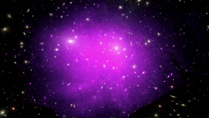
In the early 1930s, astrophysicist Fritz Zwicky studied the Coma Cluster—shown here in an image obtained by NASA’s Chandra X-ray Observatory—and discovered a puzzling inconsistency that led him to theorize the presence of dark matter. Photo Credit: NASA
Missions Focus on Dark Matter, Dark Energy

New telescopes designed to address pressing mysteries in astrophysics.
Read More
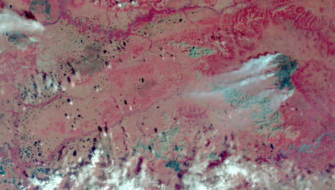
Within days of the launch, Landsat 1 acquired an image of an astounding 81,000-acre fire burning in isolated, central Alaska. For the first time ever, scientists and resource management officials were able to see the full extent of damage from a fire in a single image while it was still burning. Photo Credit: NASA/USGS
This Month in NASA History: A Closer Look at Earth

Landsat 1 demonstrated the value of multispectral scanner technology.

Read More
A high-resolution free-air gravity map based on GRAIL data, overlaid on terrain based on LRO altimeter (LOLA) and camera (LROC) data. The view is south-up, with the south pole near the horizon in the upper left and the crescent Earth in the distance. The terminator crosses the eastern rim of the Schrödinger basin. Gravity is painted onto the areas that are in or near the night side. Red corresponds to mass excesses and blue to mass deficits. Credit: NASA
Podcast Episode 112: TechLeap Nighttime Precision Landing Challenge

NASA TechLeap Nighttime Precision Landing Challenge Manager Greg Peters discusses the lunar landing challenge.

Listen
Featured Video: Introducing NASA’s On-Demand Streaming Service, NASA+

More space. More rockets. More science. More missions. More NASA. All in one place. No subscription needed.

Watch Trailer