

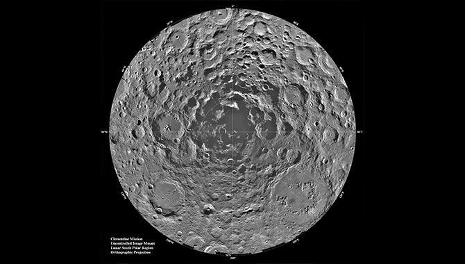
The moon’s cold, dark south polar region, which never receives direct light from the sun, is portrayed through a compilation of 1500 images taken by the Clementine mission.
Image Credit: NASA
Fourteen years ago this month, a joint NASA/Department of Defense (DoD) mission spun out of control—but not before detecting water in the darkest region of the moon.
To survive off Earth, humans have certain fundamentals needs. Food. Oxygen. Water. For prolonged human spaceflight to be possible, astronauts must be able to carry these resources with them or locate them in-situ, which is why NASA continues to investigate sources of water on Mars to support an eventual manned mission to the red planet.
The moon, in contrast, appears barren and dry. Samples returned during the Apollo missions found no evidence of lunar-based water. Still, scientists speculated about the possibility of finding the substance on the moon. They knew it didn’t exist underground, but they thought it might be located in places where water-rich objects, such as comets, had impacted the surface. The problem was that because the moon lacks a magnetic field and an atmosphere, any comet-borne water would evaporate quickly upon exposure to the sun. The only place water could persist would be in the shaded regions around the lunar poles, which had yet to be examined.
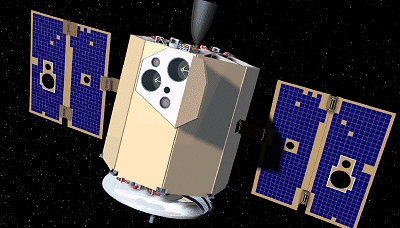
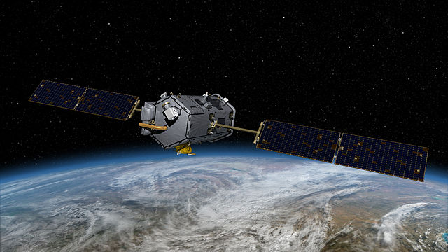
Artist’s rendering of the Clementine spacecraft.
Image Credit: NASA
The opportunity to explore these dark regions came in 1994 with Clementine, a NASA/DoD project. As a technology demonstration mission, Clementine’s objective was to assess sensor and spacecraft component performance over the course of long-duration exposure to space. The plan was to begin by mapping the surface of the moon at a variety of wavelengths, from ultraviolet to infrared, before moving on to the near-Earth asteroid 1620 Geographos. NASA and DoD were particularly interested in learning more about the surface minerology of both objects and in further characterizing the size, shape, and other properties of Geographos. Results from the mission would inform future technology development while possibly expanding the potential for asteroid mining.
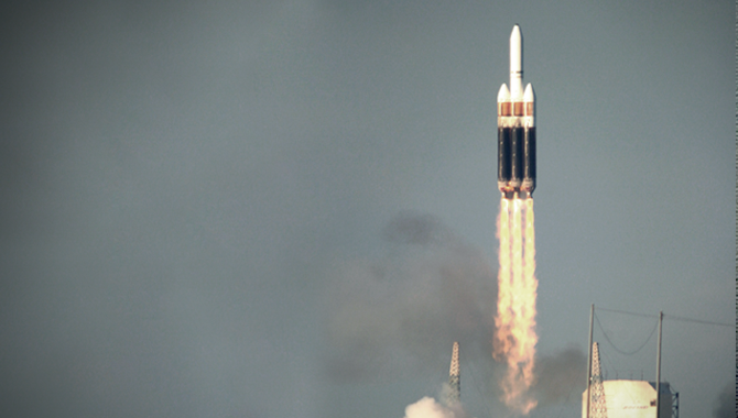
On January 25, 1994, Clementine shot into space from Vandenberg Air Force Base on a Titan II ICBM. The satellite was an octagonal prism just under two meters high and a little over a meter wide. Dry, it weighed about 227 kilograms, but with fuel the weight doubled. One end held a thruster for maneuvers, the other a high-gain antenna for communication. The spacecraft carried multiple instruments: an ultraviolet/visible (UVVIS) camera, a near-infrared (NIR) camera, a long-wave infrared (LWIR) camera, a high-resolution (HIRES) camera, a laser altimeter (LIDAR), and a charged particle telescope. Two star tracker cameras, used mainly for attitude determination, also provided wide-field capabilities. An S-band microwave transponder supported communications, tracking, and a gravity experiment. The sensors were all on one side, far from the solar panels that provided power. Twelve small attitude-control jets worked to orient the spacecraft for pointing the cameras at targets.
The spacecraft reached lunar orbit on February 19. For the next 71 days, Clementine imaged the moon at different wavelengths and conducted laser ranging altimetry, gravimetry, and charged particle measurements. Ultimately, the mission mapped 38 million square kilometers in 11 visible and near-infrared colors. It produced nearly a million images: 620,000 high-resolution pictures and roughly 320,000 mid-infrared thermal images. In addition to uncovering new information about the surface gravity field of the moon, Clementine studied complex regions in detail, providing new data on composition and topography. Previously unseen regions were revealed as well, including a large basin in the southern polar region that is never exposed to sunlight. There, in the shadow of the moon, the world was dark and extremely cold. A large basin about 300 kilometers across, possibly an impact crater, appeared to hold water ice. Clementine sent radio waves into the region, an experiment that revealed abundant ice deposits. Although the results were not conclusive for water, they spurred excitement that a supply could exist on the moon’s surface, making it potentially easier to establish a lunar outpost than previously believed.
Most of the spacecraft’s sensors and instruments performed as well or better than expected during the lunar survey. On May 3, Clementine left the moon behind to head for the asteroid Geographos. Four days later, on May 7, the mission’s future was abruptly rerouted when an onboard processor mistakenly triggered one of the attitude control thrusters. The spacecraft spun at 80 rpm for more than 10 minutes before the system ran out of fuel. At that point, the mission team had a choice. They could continue toward Geographos, but without a working attitude control system, Clementine would be unable to perform useful observations. The other option was to find a different means of continuing the technology demonstration aspect of the mission. They chose the latter, directing the spacecraft into orbit around Earth at an altitude where it would pass through the Van Allen radiation belts to test onboard components in that challenging environment. The mission ended the following month when the power level dropped too far to maintain communication between the spacecraft and Earth.
Although Clementine was unable to complete the asteroid flyby, the information returned during the earlier phase of the mission was excellent. It produced the first digital dataset for the moon, with nearly a million new images—including observations of never-before-seen regions—and a promise of water in a place that previously appeared bone-dry. More than a decade passed before the presence of water on the moon was confirmed. In 2008, the Indian Space Research Organization (ISRO) launched Chandrayaan-1, whose Moon Mineralogy Mapper observed water molecules on the lunar surface. Then, in 2009, NASA’s Lunar CRater Observation and Sensing Satellite (LCROSS) probe deliberately impacted the moon’s southern pole to produce a debris cloud that could be analyzed for signs of water ice. The mission was a success: water components showed up in both infrared and ultraviolet spectroscopic measurements. At long last, Clementine was proved correct.
Learn more about the Clementine mission.
Explore a National Academies of Sciences, Engineering, and Medicine publication: Lessons Learned from the Clementine Mission.