
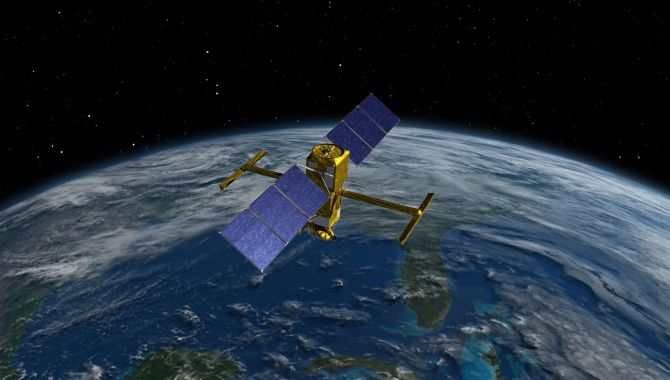
The Surface Water and Ocean Topography (SWOT) satellite, shown here in an artist’s illustration, will make unprecedented measurements of the water in Earth's lakes, rivers, reservoirs, and oceans.
Credit: NASA
Satellite will provide high-definition view of lakes, rivers, and oceans.
In 2022, water levels at Lake Mead, a crucial source of drinking water for about 25 million people and irrigation for a vast swath of agricultural land, dropped to just 30 percent of capacity—the lowest level since the late 1930s, when the lake was first filling. Nearby on the Utah-Arizona border, Lake Powell was at about 26 percent of capacity. Across the world, China’s Yangtze River hit the lowest levels since record-keeping began in 1865. In Italy, picturesque Lake Como and Lake Garda hit record low levels as well.
Meanwhile, sea levels continue rising. The National Oceanic and Atmospheric Administration projects another 10-12 inches of sea level rise by 2050 along the U.S. coastline. If these projections bear out, that will equal the sea level rise seen in the 100 years between 1920 and 2020, but in just 30 years.
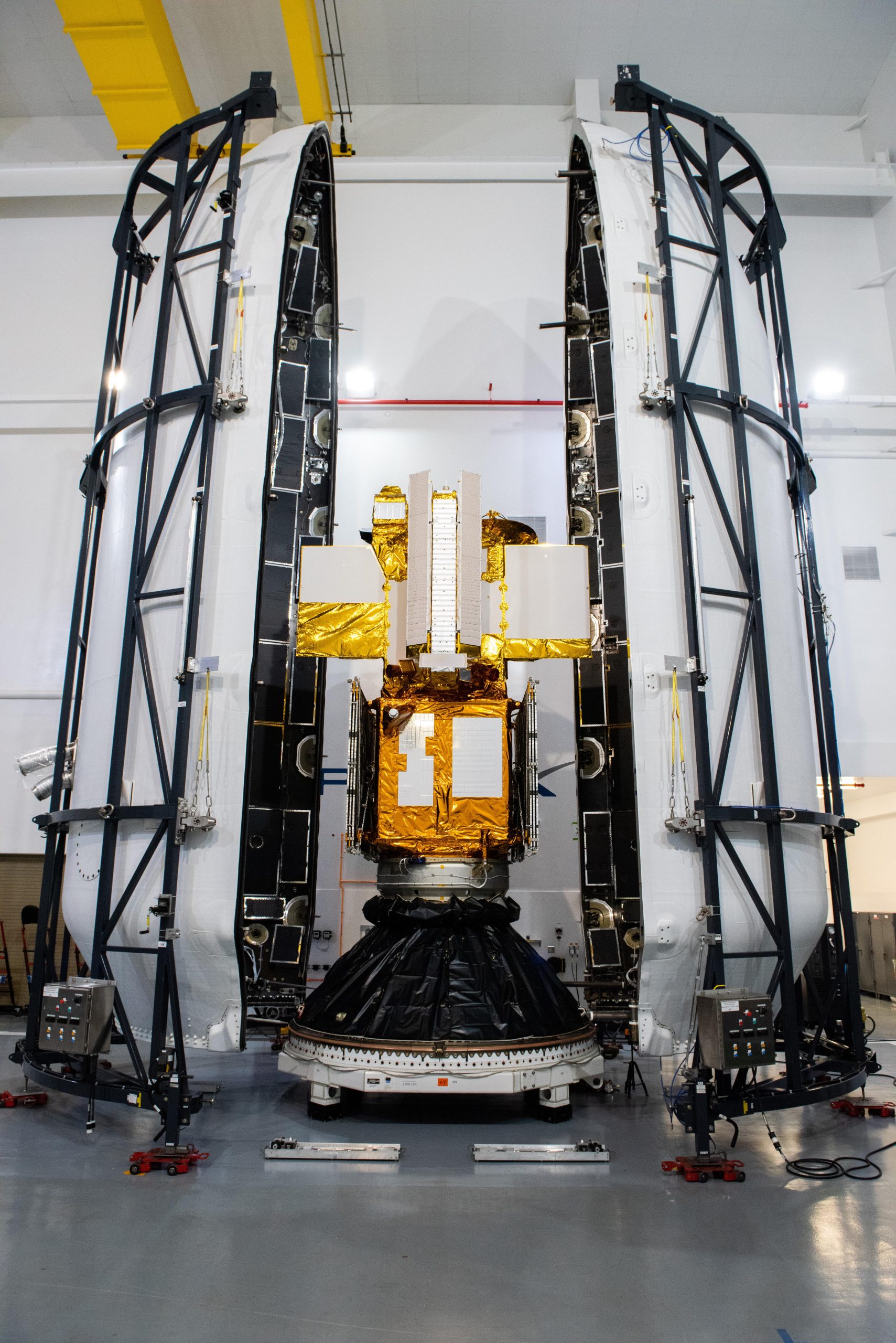
The SWOT water-tracking satellite was encapsulated in its payload fairing on Dec. 8.
Credits: USSF 30th Space Wing/Joshua Duff
In 2008, a group of international scientists first proposed a satellite mission to create a high-resolution global inventory of Earth’s water resources. The resulting Surface Water and Ocean Topography (SWOT) satellite is the product of an international partnership between NASA and the French Space Agency Centre National D’Etudes Spatiales (CNES) with contributions from the Canadian Space Agency (CSA) and United Kingdom Space Agency.
SWOT, which was launched from Vandenberg Space Force Base on December 16 aboard a SpaceX Falcon 9 rocket, builds upon decades of successful missions beginning with TOPEX/Poseidon in 1992, followed by Jason-1, Jason-2, and Jason-3. The SWOT spacecraft bus and payload module is 16.4 feet tall, with a mass at launch of 4,850 pounds. SWOT is powered by a pair of solar arrays that unfold on orbit to span 48.8 feet and combine for 335 square feet of surface area. Small rocket engines, fueled by a propellent tank, will be used for orbital adjustments.
“SWOT is a pathfinder mission addressing transformative questions on water and energy … by making measurements of the elevation of the water surface of the world,” said Lee-Lueng Fu, SWOT Project Scientist at NASA’s Jet Propulsion Laboratory, speaking at a November NASA press conference. “A conventional radar altimeter looks straight down, sampling a one-dimensional profile of water elevation. … SWOT, however, [will make] two-dimensional measurements of water elevation over a swath on each side of the satellite’s ground track.”
The new instrument that makes these precision measurements possible is known as KaRIn, an acronym for “KA band radar interferometer.” On orbit, SWOT will deploy booms that together span 33 feet. The team will then deploy a 5-meter-long antenna at each end of the boom. The system is designed to gather data from two 30-mile-wide swaths of Earth’s surface, simultaneously.
“The radar sends electromagnetic pulses from one antenna that reflect off the surface of the Earth and are received by both antennas at the same time. This provides a very precise measurement of the height using a triangulation technique called interferometry that lets us create a 2D map of the surface water,” explained Parag Vaze, SWOT Project Manager, JPL, speaking at the same NASA press conference.
In addition to this reflected signal, the team also needs to know to an exacting degree the position of the satellite. A suite of instruments aboard SWOT will help the team discern the satellite’s position as it orbits Earth at more than 17,000 miles per hour, 500 miles above the planet’s surface.
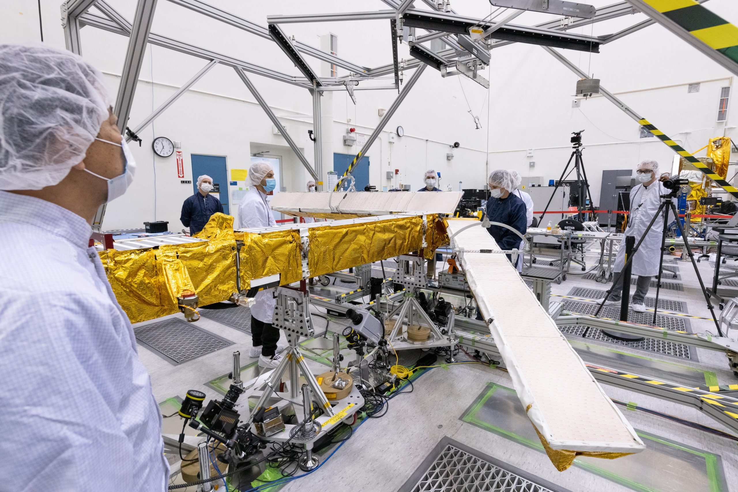
Members of the SWOT mission test one of the antennas for the Ka-band Radar Interferometer (KaRIn) instrument in a clean room at NASA’s Jet Propulsion Laboratory in Southern California.
Credits: NASA/JPL-Caltech
One key source of SWOT positioning data is DORIS, an acronym for Doppler Orbitography and Radiopositioning Integrated by Satellite. The DORIS receiver, using an omnidirectional antenna, will measure changes in the frequency of radio signals transmitted by a series of beacons on Earth. By examining this Doppler shift, DORIS can provide incredibly precise, real-time data on the satellite’s trajectory and location. By using both 400 MHz and 2 GHz signals every 10 seconds, the system can better cancel out errors caused by atmospheric conditions, such as water vapor.
“SWOT will cover the world between 78 degrees north and 78 degrees south every 21 days, providing a high-definition view of the surface water and ocean topography,” Fu said. “The observation of the surface water on land is what we need to assess the budget of fresh water. In a warming climate, the Earth’s water cycle is accelerating, making water resources difficult to track and manage.”
“Where is the water? Where does it come from? And where does it go? These are important questions we’re not equipped to answer because the world’s rivers and lakes are poorly sampled in many places,” Fu continued. “SWOT will make a quantum jump by making observations from space to create a global inventory of water resources.”
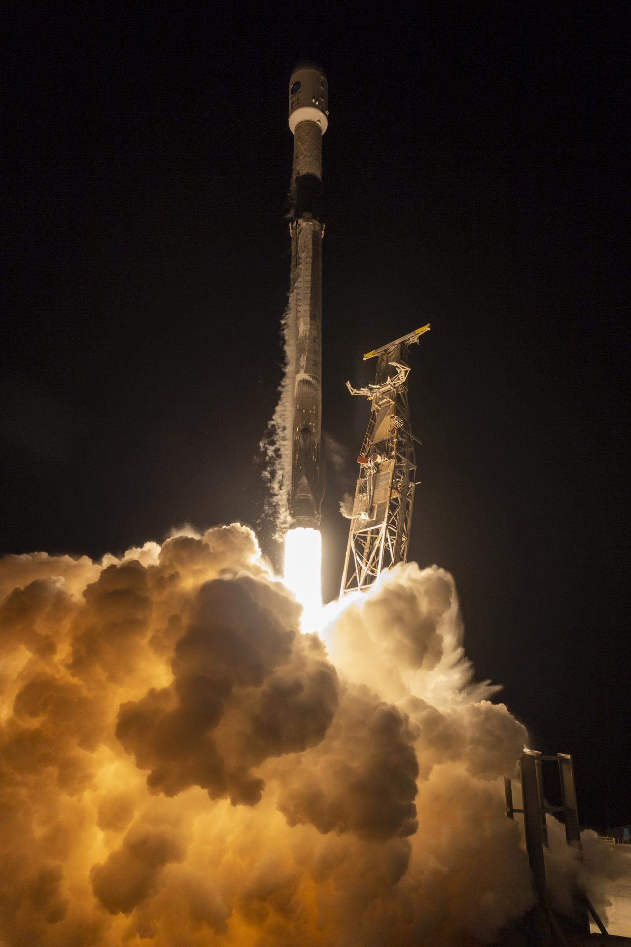
A SpaceX Falcon 9 rocket launches with the SWOT spacecraft onboard, Friday, Dec. 16, 2022, from Space Launch Complex 4E at Vandenberg Space Force Base in California.
Credits: NASA/Keegan Barber
SWOT data will also give scientists a clearer picture of how sea levels are rising along the world’s coastlines, filling in knowledge gaps that currently exist, and aiding leaders as they plan to mitigate the impacts of sea level rise.
And, because more than 90 percent of the heat from global warming is absorbed and stored in oceans, SWOT data will provide scientists with unprecedented insight into this dynamic interaction between water and energy.
“Without the ocean, Earth’s surface temperature would be a whopping 67 degrees Celsius, or 153 degrees Fahrenheit. Such a scorching Earth is certainly not inhabitable. The absorption of heat by the ocean takes place at a small scales, not presently observable from space. SWOT will make high-definition views of ocean topography, revealing the swirls of ocean currents that are responsible for heat uptake by the ocean,” Fu said.
The international collaboration that developed SWOT moved forward as NASA and CNES adapted to new work requirements during the COVID 19 pandemic. Satellite integration occurred at JPL, then the satellite was shipped to France for 14 months of testing, before being shipped to Vandenberg Air Force Base for launch preparations. In 2020, the CNES team was working at JPL and was able to leave just before international flights were cancelled.
“…All the teams joined their efforts to find out practical ways to be able to protect the schedule. And we were able to successfully complete a complex integration and testing period…,” said Thierry Lafon, SWOT Program Manager, CNES. “That was really a great demonstration of [the] resilience and inventiveness of our teams.”