


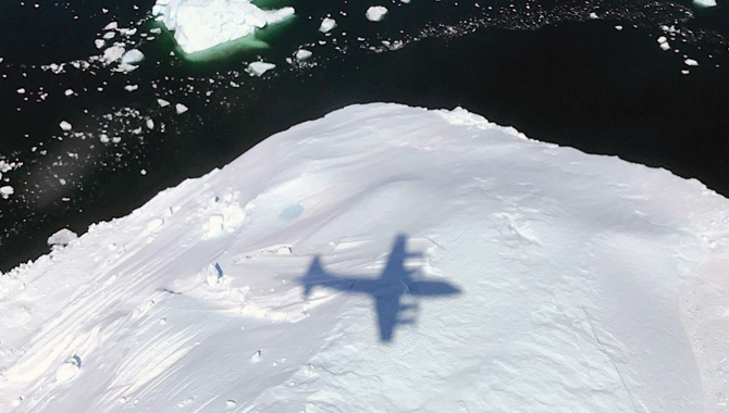
The shadow of NASA's P-3 aircraft is seen over an iceberg on a May 8, 2017 flight. The plane, which carries sophisticated technology, will fly through snowstorms on the U.S. East Coast in a three-year project to better understand how snow bands form.
Credit: NASA/Joe MacGregor
New NASA research project employs an impressive array of technologies to discern how and why snow bands form.
The most powerful winter storms on the U.S. East Coast disrupt millions of lives, closing airports, public transportation, highways and schools. They live on for decades in the stories of the people who struggled through them, shoveling through feet of snow to find cars or to relieve pressure on straining roofs. Even smaller storms have the potential to create a wide-spread disruption and economic losses in the densely populated corridor.
Within these storms is a scientific mystery. Why do long, narrow areas, known as “snow bands,” form in some of these storms and not in others, significantly increasing snowfall totals? To better understand this feature of the storms, NASA has begun a three-year research project known as IMPACTS, an acronym for Investigation of Microphysics and Precipitation for Atlantic Coast-Threatening Snowstorms.
“Snow is unevenly distributed within each storm. Some places receive a lot of snowfall, and others hardly any,” said Lynn McMurdie, a Research Associate Professor at the University of Washington who is the Principal Investigator on the Project. “We’re trying to understand the processes that contribute to the evolution of these snow bands within the storms and how that varies from storm to storm.”
The IMPACTS project will benefit from dramatic technological advancements in the decades since East Coast winter storms were studied to this extent. IMPACTS will deploy an impressive array of equipment to examine the storms from above the clouds, below them, and within them during six-week windows in 2020 and the following two years. The team will use Doppler radar on the ground to quantify snowfall distribution and intensity.
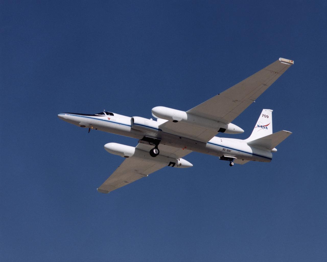
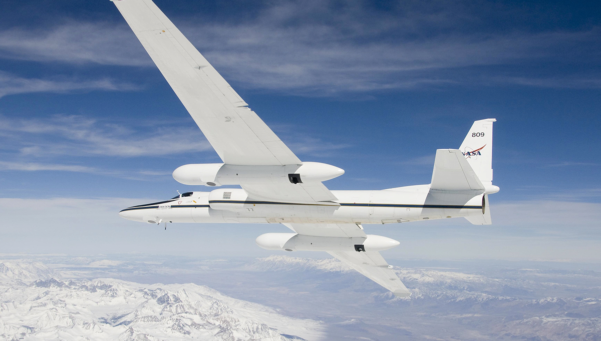
The ER-2 aircraft were platforms for a variety of high-altitude science missions flown over various parts of the world. They were also used for earth science and atmospheric sensor research and development, satellite calibration and data validation.
Credit: NASA/Tony Landis
NASA’s ER-2 high altitude aircraft, which has the capability to fly above 99 percent of the Earth’s atmosphere, will gather data from high above the storm, at an altitude of 68,000 feet. The ER-2 is equipped with advanced radar, lidar, and microwave radiometer remote sensing instruments. This will produce data similar to that of a satellite, while enabling the team to pinpoint the instruments’ locations, to align with a NASA P-3 Orion aircraft flying through the storm.
The P-3 Orion is a four-engine turboprop aircraft based at NASA’s Wallops Flight Facility. It carries a suite of instruments to investigate the environment in which snow crystals form and the shapes, sizes and numbers of snow crystals at these different levels. It is equipped with what are known as “dropsondes,” small cylindrical instruments dropped from the plane, via parachute, to measure pressure, temperature, and moisture as they descend through the clouds.
“The P-3 will have instruments called microphysical probes, which take pictures of the snow crystals and can be used to determine the number of snow particles, and the liquid and ice water content of the atmosphere,” said McMurdie, in written comments to INSIGHT.
Coordinating the actions of the multiple teams who are keeping two highly sophisticated aircraft flying in alignment through busy commercial air corridors is a challenge that requires effective communication and a clear line of authority. “We have an excellent team of people involved with the project and there have been very few, if any, glitches with operations,” McMurdie said.
“The instrumentation being used in IMPACTS are all chosen to document different aspects and scales of snow band structures and also provide the storm-scale context of those snow structures,” McMurdie explained. “The surface based soundings and dropsondes from the P-3 aircraft provide the horizontal and vertical environmental context of the storm structure, the remote sensing instruments on the ER-2 document the horizontal and vertical structure of the snow bands and the microphysical probes on the P-3 provide the detailed information on the scale of the snow particles themselves.”
Together, this sophisticated instrumentation creates a massive flow of data, quickly measuring in terabytes. The team tracks these multiple data feeds in real time to ensure the data is flowing and being archived for future analysis.
“We hope to characterize the spatial and temporal scales and structures of snow bands, understand the processes on multiple scales that produce snow bands and apply this understanding to the improvement of remote sensing and forecasting of snowfall,” McMurdie said.
“Snow-covered trees and ice-covered ponds are picturesque but falling snow can snarl traffic and close airports and negatively impact society. It’s important to understand all aspects of snowstorms from the factors that contribute to the large-scale cloud systems down to the processes in the clouds that create the snow crystals themselves,” McMurdie said.
The IMPACTS team has a wide range of expertise, with members drawn from several of NASA’s centers as well as key academic research partners. Deputy P.I.s on the project are Scott A. Braun, research meteorologist, Gerald Heymsfield, research meteorologist, and John Yorks, physical research scientist, all based at Goddard Space Flight Center in Greenbelt, Md.