


NASA’s Edward Kim and NOAA’s Pam Sullivan discuss NASA’s role in weather research.
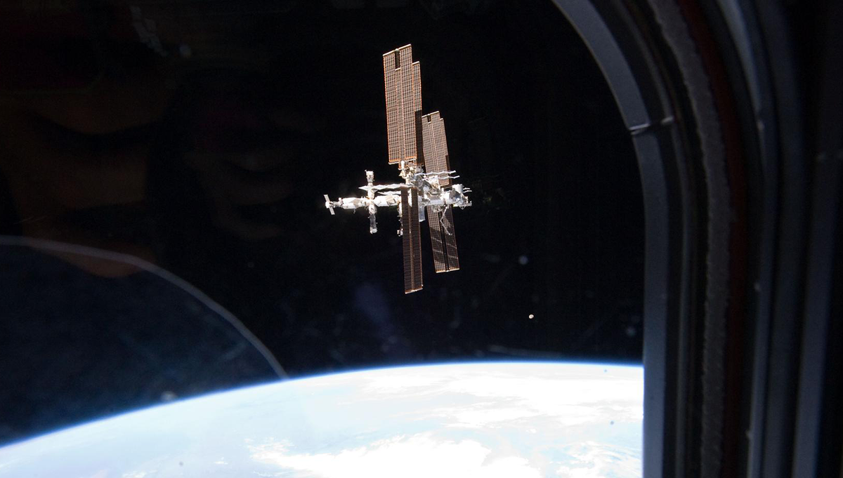
For more than 50 years, weather satellites have been an indispensable tool for life-saving weather and climate forecasts. NASA and the National Oceanic and Atmospheric Administration have partnered to successfully deploy more than 60 weather satellites. The NOAA-NASA partnership has significantly advanced Earth observation capabilities to improve weather forecasting, storm prediction, and climate observations.
In this episode of Small Steps, Giant Leaps, you’ll learn about:
- Successful, long-duration collaboration between NASA and NOAA
- Geostationary and polar orbiting weather satellites
- Next-generation weather satellites
Related Resources
Joint Polar Satellite System (JPSS) Program Office
Multimedia Storymap: The Most Important Instrument You’ve Never Heard of
APPEL Courses:
Complex Decision Making in Project Management (APPEL-vCDMPM)
Critical Thinking and Problem Solving (APPEL-vCTPS)
Systems Thinking Across the NASA Project Lifecycle (APPEL-vSTNPL)
Strategic Thinking for Project Success (APPEL-vSTPS)

Pam Sullivan
Credit: NASA/Kim Shiflett
Pam Sullivan is the NOAA National Environmental Satellite Data and Information Service’s System Program Director for the GOES-R Series Program. Sullivan is in charge of the development, integration, and launching of the Western Hemisphere’s most advanced weather-observing and environmental-monitoring satellites. She oversees development of the spacecraft and instruments as well as the ground system that receives data from the satellites, generates data products, and distributes the products to forecasters. The GOES-R Series includes NOAA’s operational GOES-East and GOES-West, GOES-T, and the upcoming GOES-U satellites. Sullivan also oversees formulation for the next generation of geostationary satellites. Before joining NOAA, she managed the GOES-R Series Flight project at NASA and served as an officer in the U.S. Air Force. Sullivan is a five-time recipient of the NASA Outstanding Leadership Medal and holds a bachelor’s degree in astronautical engineering from the Massachusetts Institute of Technology.

Edward Kim
Credit: NASA
Edward Kim is the Advanced Technology Microwave Sounder (ATMS) Instrument Scientist at NASA’s Goddard Space Flight Center. The ATMS instruments on the Joint Polar Satellite System’s NOAA-20 and Suomi-NPP satellites feed the weather models that inform daily forecasts and help with planning for extreme weather. Kim leads a team of specialists to characterize instrument performance, verify it meets requirements, and ensure proper operation before and during routine operations by NOAA. Working as a remote sensing research scientist for NASA since 1999, he helps develop new instrument and mission concepts and algorithms, build and test prototypes — often on research aircraft — and use satellite data to answer science questions and develop data products for a variety of applications. Kim received bachelor’s and master’s degrees in electrical engineering from the Massachusetts Institute of Technology and the joint Ph.D. degree from the University of Michigan Department of Electrical Engineering and the Department of Atmospheric Sciences.
Transcript
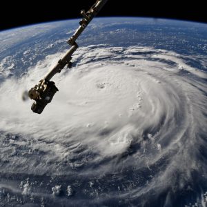
Pam Sullivan: The satellites are probably most well-known for the images that they take of advancing hurricanes, but really, they watch everything that’s going on, whether that’s clear skies or thunderstorms, ice storms, snow, flooding, fire, smoke, and even volcanic ash.
Edward Kim: Having multiple polar orbiting satellites giving you observations at different times during the day allows the weather forecasters to put together a three-dimensional picture of the atmosphere, which is exactly what you need when you’re trying to do a weather forecast.
Deana Nunley (Host): You’re listening to Small Steps, Giant Leaps, a NASA APPEL Knowledge Services podcast where we tap into project experiences to share best practices, lessons learned and novel ideas.
I’m Deana Nunley.
Satellite technology has drastically changed weather forecasting. And our conversation today is with a couple of experts on Earth-observing satellites – NOAA’s Pam Sullivan and NASA Goddard Space Flight Center’s Edward Kim.
Pam and Ed, welcome to the podcast. Thanks so much for joining us.
Sullivan: Oh, great to be here. Thanks for having us.
Kim: Yeah. Glad to be here.
Host: Could you tell us about your current role and the path that led you to what you’re doing now?
Sullivan: Oh, well, for me, I knew I wanted to be in the space program since I watched the Moon landings when I was a five-year-old. And that passion brought me to work, first, in the Air Force where I worked on the Space Shuttle Program, and then to NASA, where I worked on weather satellites, as well as science research missions like Hubble and James Webb. And then finally, to NOAA, where my current job is that I lead the team that’s developing NOAA’s geostationary weather satellites.
Kim: Yeah. And for my part, I also watched the Moon landings when I was five and I don’t think I missed a single one of them. So any kid growing up around that time probably did the same thing, but it never occurred to me to go work for NASA. I was always interested in engineering. So I followed a pretty typical path of going to school to get engineering degrees. And then almost purely by chance, ended up taking a job with NASA, and almost purely by chance, ended up working on the weather satellites that NASA helps NOAA build.
Host: Do you think the collaboration between NASA and NOAA is different than typical inter-agency efforts?
Sullivan: I do. For one, it’s really long. I mean, it started really at the very dawn of the Space Age. NASA launched its first weather satellite in 1960 and NOAA was involved in the project then, and very quickly, they started using the images and the data for weather forecasting. And before long, they realized this data is indispensable really for their mission. And they realized they needed, not just a short, sort of research-aimed mission, but they wanted long-term continuous observations. And they kept that partnership with NASA over all of these years. Every weather satellite that has been developed has been between the two agencies.
Kim: Yeah. And I would add that what NASA brings to the table, it’s a really great collaboration. The two specific agencies, NOAA and NASA in particular, have a really great collaboration when it comes to weather satellites. The parts that NASA does are really tailored to NASA’s expertise and experience. And the part that NOAA does is also similarly tailored to what NOAA’s got a lot of expertise and experience with. NASA, of course, and NOAA as well, collaborate with a large number of other government agencies. And I think in those cases, it’s a similar situation. Each inter-agency relationship is tailored to what those two agencies need from each other. So, in the case of NASA and NOAA, it’s a great partnership and a long-running one, as Pam just pointed out.
Host: And Pam, from a project management standpoint, what do you think has made this successful?
Sullivan: I think it’s both the complementary and the shared missions of the two agencies. Both agencies have a mission to better understand our universe and to share that information for the benefit of humankind. Both agencies are really built with science as the core, so those are the things that they share. And then the complementary nature, of course, is that NASA does the development and the engineering, and then NOAA uses that data and develops the science products, and translates the information, gets it out to the public in a way that people can use. So yeah, very complementary.
Kim: I would second that. I think there’s both similarities and differences. The two agencies both use satellites to look at the Earth and extract information from the satellite observations that people can use for all sorts of different purposes. So that’s extremely, it’s essentially the same for both agencies. But there are some important differences. NOAA is really much more of an operational agency. I mean, they have congressionally mandated things they’re required to produce, weather forecasts, et cetera, hurricane forecasts, I mean, you name it. NASA’s more of a research agency. So, NASA has, of course, its own just pure NASA satellite missions, Earth-sensing ones are the ones, at least, I’m more familiar with. And they are more research-centric, and they tend to be more cutting edge maybe in terms of either the technology, or how the observations are used. And maybe the first time a particular type of observation has been obtained. And so of course there isn’t necessarily a long history of how you would use that information.
So, whether or not the observations from a NASA mission lead specifically to something immediately that the person on the street can use — well, that’s not the immediate goal necessarily of many of the NASA missions. Eventually, you expect what we learn, the technology that’s developed and so on, to produce tangible benefits for society and people, the average person on the street. But in the case of NOAA, it’s much more direct. The observations from the NOAA satellites, like weather forecasts are the perfect example, they’re intended to be used by the public immediately.
Host: Do you have any additional thoughts, Ed, on what has made this successful from a science perspective?
Kim: Well, like for every observation, there’s science behind it, as well as technology, right? The science comes into play in the form of understanding what you’re looking at. There are very few sensors that directly measure something that you may be interested in, for example, the intensity of a hurricane or the rain rate in your backyard. In the case of rain rate, for example, we have sensors that directly measure information about water droplets in the atmosphere. That has to get translated into something like rain rate and those translations are done with algorithms. And that’s where science comes into play, figuring out how to translate a physical quantity that you can observe into something that you want for your weather forecast, for example. There’s also science that goes into the physics of how the observer, the sensor works itself, but that maybe is usually considered more technology.
So, NASA does a lot of technology development. It’s not the only organization that does that, but because of NASA’s interest in space missions and observations and sensors, NASA’s involved in a lot of technology development, has entire departments that do nothing but technology development. And then that technology is used to design satellite sensors and those get used in missions. And so the science plays a role in, again, starting with the physics of the phenomenon that the sensor can actually measure all the way to the quantity that, for example, a weather forecaster is trying to get out to the public.
Host: Well, and that’s a good lead-in for a question that I have for both of you. And that is, how would you describe NASA’s role in weather research and the impact it has on people’s lives?
Sullivan: Well, I think NASA is really the pathfinder. Almost every instrument that we fly on NOAA weather satellites had a precursor instrument that was developed first as a science mission by NASA. Designed, built and flown by NASA. So very direct lineage that you can point to for, again, for the Earth-observing and, frankly, the space weather observing instruments. The other part of it is, NASA, of course, does research into Earth systems, understanding the properties and behaviors of atmosphere, oceans, ice sheets, land mass, and that research leads to an understanding of how the Earth systems behave, which leads to an understanding of how to predict them and develop models. And again, those are used directly now by NOAA in their numerical weather prediction. So most of, I would say, NOAA’s mission is built on the research that has been done by NASA.
Kim: Pam did a great job of explaining that. And I would say that also, I mean, in what I would call the earlier phases of things, developing the prototype sensors and launching them and figuring out how they work, that tends to be primarily done by NASA, and historically has been. The understanding of the Earth itself and techniques for doing weather forecasting, for example, that’s certainly –that kind of work does — NASA does that sort of research. NOAA also does quite a bit of that. So in those areas, both agencies do quite a substantial amount of work in those areas. But the sensors, the observations, the satellites, especially the technology aspects of those, getting the prototypes, dreaming up the prototypes in the first place, building the prototype, launching it, and figuring out how to actually use, that primarily is done, has been done historically, and still is done by NASA.
Host: Let’s talk about specific satellites. So Pam, could you tell us about the GOES series of satellites?
Sullivan: Oh yeah, my baby. Sure. Well, to start with, GOES is an acronym, of course, stands for Geostationary Operational Environmental Satellites. And again, I need to talk about history here because we have been flying GOES satellites for a long time. The very first one was launched in 1975. Now that was after NASA had pioneered a couple of geostationary weather satellites ahead of that. But the first one that we called GOES-1 was launched in ‘75. And ever since then, there’s been at least one GOES satellite observing over the U.S. And then just last March, we launched the 18th GOES satellite. It’s currently in checkout. We actually just released the first-light data from its main camera. And so we’ve got our fingers crossed, but everything is looking very good with our GOES-18 satellite.
Currently, our operational concept is to fly the satellites in pairs. So we put one GOES satellite at the equator over the East Coast. And one at the equator at a longitude about near where the West Coast is. And so between the two of them, they both observe the North, South America land mass, but then the east one sees all the way across the Atlantic over to Africa. And the west satellite sees almost all the way across the Pacific, over to New Zealand. And with the two satellites together, of course you can see the main weather patterns that affect the U.S. travel west to east.
So, the west satellite sees sort of the upstream storms. And then the east satellite sees those very particular storms called hurricanes that tend to travel east to west. And so with the two of them together, the GOES satellites really see all of the weather and other dangerous environmental phenomena that are going on. And the satellites are probably most well-known for the images that they take of advancing hurricanes, but really, they watch everything that’s going on, whether that’s clear skies or thunderstorms, ice storms, snow, flooding, fire, smoke, and even volcanic ash.
Host: You shared some fun facts, especially the history about the GOES satellites. Are there other fun facts or some benefits that you’d want to talk about that maybe most of us don’t even realize we’re getting from this mission?
Sullivan: Well, I work with a guy who says, ‘You use GOES data every day, even if you don’t know you do,’ because the data that goes into it goes into watches and warnings. When there’s dangerous weather, you hear a hurricane warning or a tornado watch. But another thing that’s maybe less well known about the GOES satellites is they are also used to forecast weather in space, and GOES-18 actually has four different instruments that are used for space weather forecasting. It has a couple that watch the Sun, that look for solar flares and eruptions. And then they’ve got other sensors that are measuring the local magnetic field as well as energetic particles in the neighborhood of the satellite.
And NOAA actually uses that data from those instruments to issue watches and warnings for space weather, just like they do for hurricanes and tornadoes. And so the people that care about space weather, and those are people that care about radio signals being transmitted, GPS signals, satellite orbits are affected by space weather. The power grid can be affected by space weather. So these watches and warnings go out to that community from the GOES satellites data as well.
Host: What are some of the improvements with the new generation of satellites – GOES 16 and GOES 18?
Sullivan: GOES-18 has a couple of sister satellites. GOES-16 was actually the first of this generation, and that was a huge step up from the previous generation. We have 60 times more data coming off of these satellites. And so that GOES-16 satellite’s actually been observing over the East Coast since 2017. And with the resolution, both the improved spatial resolution and the improved temporal resolution, forecasters have gotten very spoiled, very fast, and they are able to better predict changes in a hurricane. They can see changes in strength, changes in direction happen much more quickly. The GOES satellites can take an image once a minute. And so forecasters, every minute, they get a new picture of that hurricane and they can tell what’s new, again, if it’s stronger, if it’s changing direction, so it’s improving the forecasts there.
And the GOES-16 satellite, again, the first of this latest generation, another thing that has really surprised folks is how well it detects fires. We knew it was going to detect fires, but the spatial resolution is so good that sometimes the satellite is the first thing that alerts people that there’s a fire in their neighborhood. And so it is helping actually with the first responders and people that are managing wild lands, to really look to the GOES data for when fires are starting, as well as looking for the forecasts when a fire is starting and which way the wind is blowing and making sure that they’re deploying their firefighters into locations that are going to be safe, based on where that fire is likely to move. So yeah, we’ve actually been very excited with this new generation. And with GOES-18, this latest one, like I said, it’s the third of this particular generation, and it’s planning to go into operation over the West Coast.
And then, now that we have three of these satellites up there, we’re going to have both the prime east, the prime west, as well as an on-orbit spare, which is another part of how we fly these satellites. We always want to have a ready on-orbit spare that we can turn on, in case of a problem with either of the operational satellites, we really want to have one on-orbit ready to go so that we can get — this data is so critical, we really don’t want a gap of any length whatsoever. And so that’s why we plan to have this on-orbit spare. And so, with the third one launched, we feel like we’ve got a complete upgrade to this next-generation series.
Host: Ed, could you give us a quick overview of the Joint Polar Satellite System?
Kim: Sure. The Joint Polar Satellite System, or JPSS, as the name says, is the part of the observational weather satellite fleet that includes the polar orbiting satellites, which are the big complement to the geostationary ones that Pam described. And the current set of JPSS satellites, there’re going to be four of them, but then they added, or they sort of grandfathered in the Suomi NPP satellite, so now that’ll mean a total of five. Those are effectively the sixth generation of U.S. civilian operational polar satellites. The very first one, I think Pam mentioned earlier, went up in 1960, the TIROS, T-I-R-O-S, Television Infrared Observational Satellites. So these were actually a series of NASA experimental satellites, but then as soon as the weather forecasters and NOAA operational folks took a look at the images, they immediately started using them for operational purposes. And that kicked off, as I said, now we’re on the sixth generation of polar orbiting satellites being used operationally to support weather forecasting.
And the JPSS satellites have a small number of sensors on board. They’re all imagers, and they observe different parts of the electromagnetic spectrum channels that are tailored to observe different parts of the Earth system, if you will. There’s a visible infrared sensor, there’s an ozone sensor, and there are two sounders. So sounding means that they give you vertical profile information about the state of the atmosphere, in particular, the temperature and humidity as a function of altitude in the atmosphere. And those two sounders, one of them works in the infrared part of the spectrum, and the other one works in the microwave part of the spectrum.
The infrared one, the acronym is CrIS, and I can’t remember what it stands for at the moment. Pam might remember. Cross-Track Infrared Sounder. Yeah, I was going to say, that’s what I think it is. And then the microwave one is the ATMS, which stands for Advanced Technology Microwave Sounder. And that’s the one I work directly with. So these four instruments are on each of the JPSS satellites, and they’re in the polar Sun-synchronous orbits that cover the entire surface of the planet daily. And there are always two of these operational in orbit. And the overall system plan is to maintain at least two and they’re in different orbits. So, if you’re standing on any particular spot on Earth, you’ll have one of these fly over your spot every day, actually twice a day at the same local time every day. And so, through JPSS, NOAA provides two of these satellites and the J in JPSS stands for joint, which refers to the fact that this is actually an international partnership.
So, the U.S. provides some satellites and some instruments, our European weather partners provide satellites and instruments, and then the Japanese also provide some instruments. So, it’s an international collaboration. I think that the weather enterprise in general has long ago become a very international enterprise. It’s overseen by the WMO, the World Meteorological Organization. And it’s one of the great international success stories. Data collected by a sensor from any country on any weather satellite is freely shared amongst the nations of the world so that everybody can improve their weather forecasts.
And the polar orbiting satellites, they orbit lower. As I said, they cover the entire globe and observe in many different wavelengths. They produce the soundings. The soundings are probably, or are considered to be the observations made by satellite instruments that have the biggest impact in weather forecast models. So, if you were to corner a weather forecaster and tell them, ‘I’m sorry, you’re only going to be allowed to have one instrument.’ We’ve been told by the weather forecasters that the one that they would least want to give up, the one that they most want to have, is actually the microwave sounder. And one of the main reasons for that is that microwaves have the ability to essentially see through clouds.
If you look at any picture taken from space of the Earth, on average, 50 percent of the Earth is covered by clouds. And so your visible sensors and most of your infrared sensors are not able to see through the clouds. So, in the 50 percent of the world that’s covered by clouds, you’re not getting information about the part of the atmosphere that’s below the clouds or conditions on the surface of the Earth. But the microwave sensors, because they’re able to penetrate through the clouds, can give you information about that. So, it really gives you this, what forecasters will call an all-weather picture of the Earth. And the microwave sensors in particular, the sounders like ATMS are what’s known as passive microwave sensors. So, most people are familiar with radar. It’s what the police use to catch you when you’re speeding. And radar will transmit a signal and then listen for their reflected return signal.
In the case of a passive instrument, there’s no transmitter around the satellite, you’re just relying on natural emission from soil and air and water, and everything that’s always emitting a little bit of energy. And the passive microwave instrument can pick that up and turn that into useful information that’s used by the weather forecasters. But that means that since there’s no transmitter and it just relies on natural signals put out by the Earth, it doesn’t matter whether it’s day or night, whereas a visible light sensor, for example, will give you a great picture in the areas of the Earth that are in daylight. But at nighttime, they have a harder time giving you good, clear, sharp pictures.
So, the microwave sensors are kind of unique in that respect and having them on these polar orbiting satellites and having multiple polar orbiting satellites giving you observations at different times during the day, allows the weather forecasters to put together a three-dimensional picture of the atmosphere, which is exactly what you need when you’re trying to do a weather forecast.
I think maybe a fun fact to throw out, NOAA has an actual, they have economists. And one of the things that NOAA economists do, is they use accepted economic analyses techniques to try to put numbers on the benefit in dollars of, for example, better weather forecasts. And I remember one number that stuck in my head from one of these analyses about 10 years ago or so, was that weather forecast information impacts about 20 percent of the U.S. GDP. And so I think in today’s dollar terms, that’s about $4 trillion. So they’re very important, and we can all think of examples of parts of industry or industries or society that depend or make use of weather forecast information.
I think one of the exciting things is NOAA’s already planning for what will eventually follow JPSS. The JPSS Program is slated to run through around 2039 or 2040. And due to some of the long lead times for planning, there’s already planning underway to figure out what will replace JPSS at the end of the JPSS Program. And some of us are involved. NASA’s involved in assisting NOAA to help figure out what that’s going to look like.
Host: If you’re looking ahead, what do you expect with the next generation of satellites?
Kim: Well, one thing for sure that’s being looked at, and it doesn’t necessarily mean it’s going to replace the kinds of satellites we have right now, more likely, it will augment that is, what you might call the CubeSat revolution. Everybody who works in the space business has heard of CubeSats, and they’re not going anywhere. People are finding more and more uses for CubeSats. So, they weigh less, they’re smaller, they’re cheaper. And so you can launch more of them more often, to the extent that you can get similar quality observations from them that you currently get from your more heritage-type satellites. Again, I don’t want to suggest that NOAA’s — NOAA certainly hasn’t made any decisions yet. And I don’t want to suggest that NOAA’s planning to replace any of the current satellites with CubeSats. But you can certainly augment the current observing fleet. If you were to add to that, some CubeSats, you could increase the number of observations that you make available to your weather forecasters, for example. And you could maybe try out some of the newer technologies that crop up in the next few years, rather than waiting until the next large backbone satellite is launched. So it’s taking advantage of technology advancements and opportunities that are coming, in large part from the commercial sector, and trying to see if they can be used to provide useful observations for the NOAA missions. And our NASA colleagues are doing it as well for NASA research purposes.
Host: Pam, your thoughts about the next generation of satellites?
Sullivan: Yeah. So, on the geostationary side, a little bit to contrast with what’s happening on the polar satellites that Ed was talking about, things like CubeSats. The designs of those are not yet to the point where people feel like they can trust them in geostationary orbit, which has more severe radiation environments, and the geo satellites are typically built to last 10 to 15 years. And so that new technology that’s like everywhere in low-Earth orbit has not quite gotten to practical applications in geo. So, we’re kind of watching that, but planning for the next generation geo satellites has started, and it’s going to be a program. We’ve already named it, it’s called GeoXO, which stands for Geostationary Extended Observations. And these satellites are also planned to observe in the 2030s and 2040s, and even into the 2050s, which kind of blows my mind. But we’re trying to look really far into the future as we’re setting the requirements for these satellites to understand what our users are going to need from observations in that timeframe.
And so, we’ve engaged with thousands of folks, literally, in our user community, from all kinds of industries, like Ed said. The weather satellites not just benefit individuals with their weather forecast, but the weather data is used by the power industry, agriculture, transportation, recreation. A huge fraction of our economy has a need for this weather information. So we’ve tried to reach out to as many users as we could talk to, to hear what they wanted to see and what they think their needs are going to be for the next generation.
So, for GeoXO, I’d say three things that we’re really excited about that are going to be new. There are three new instruments that we’re planning on adding. So we’re going to keep doing sort of the main cameras that we have right now, but we’re going to add to that, an atmospheric sounder instrument. This is one of the instruments that Ed talked about we have in the polar orbits. But people have really gotten used to that real time, nearly instantaneous view that they get from geo, and so we’re going to do a sounder that can provide information that will really be used for now casting, for taking hourly looks at the U.S. to look for where is convection starting to happen, where are we going to have weather, and provide that real time information to forecasters.
One of the main drivers for the sounder instrument is just that people need better forecasts, right? Our users, when we’re asking them what they need, they’re saying climate change is really driving — hurricanes are getting stronger, all storms are getting wetter. In general, the weather is getting more unpredictable. And so the sounder observations combined with improved numerical weather forecasting is really going to try to address that need, that we’ve heard from our users.
A second instrument that we’re planning on adding is an ocean color instrument. This is another one that’s been used in low-Earth orbit, but again, people really want that instantaneous data that you can get from geo orbit. And so, our ocean color instrument is being planned to have, roughly every three hours, scans of basically the U.S. coastal areas, as well as Great Lakes, Caribbean. And so, one of the main things that people want that for is to address the phenomena of harmful algal blooms, which, when I was a kid, I never heard of beach closures. But now, beach closures perhaps, happen all the time, hundreds of times a year. And so people really want to be able to watch where these harmful algal blooms are happening, how fast they’re spreading, in order to be able to more accurately predict when areas are affected, so that they can take measures to protect against that.
And then third instrument that will be new for geostationary orbit will be an air quality instrument. And this is another one of these examples where NASA’s doing the first one. NASA’s flying an air quality instrument called TEMPO late this year, and it will be designed basically to look at the atmosphere across the U.S. hourly. And it will be looking for nitrous oxide and things like formaldehyde and ozone and things that are not so good for people to breathe. So it’ll be doing an hourly measurement of air quality, and it’ll last for a few years.
And then for GeoXO, we’re planning to build on that NASA research instrument and turn that into an operational instrument. And then, basically, if all goes well, we’ll be making that measurement forever. And it’s really, really important. I was actually shocked to learn just how wide the health impact is due to poor air quality. There’s really over a hundred thousand deaths a year, due to poor air quality. And so, we’re hopeful, with better forecasting of air quality, we’ll better able to tell people, ‘Stay inside, don’t be outside,’ or, ‘Don’t be doing strenuous activities.’ We’re really hoping to be able to have the data that will allow people to limit their exposure to that, and hopefully, make a positive health outcome there.
Kim: Yeah. I might add that the program that’s going to look at the future polar orbiting satellites also, as Pam mentioned, on the geostationary side, that program has been named GeoXO. So, the complement on the polar orbiting side has been named L-E-O, Low Earth Orbiting Program. And they’re doing very similar things with respect to sensors and satellites in the polar orbits.
Host: Many thanks to Pam and Ed for joining us on the podcast. You’ll find their bios on our website at APPEL.NASA.gov/podcast along with a show transcript and links to related resources.
If you’d like to hear more interviews and get information about what else is happening at NASA, we encourage you to check out other NASA podcasts at nasa.gov/podcasts.
As always, thanks for listening to Small Steps, Giant Leaps.