By Kerry Ellis
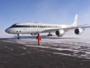
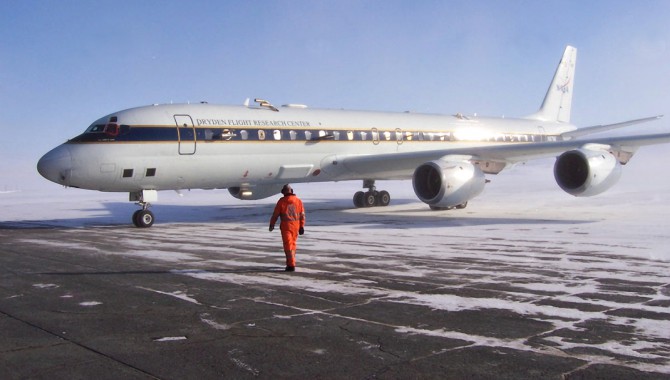
The Airborne Science Program within NASA’s Science Mission Directorate has helped take Earth science to suborbital heights. With a fleet of customizable aircraft, the program offers scientists unique opportunities to conduct airborne studies all over the globe. Its DC-8 Airborne Science Laboratory can house numerous experiments simultaneously, with many scientists aboard operating their science instruments and assessing data in close to real time. The actual flight plan rarely looks the same as the mission plan at takeoff, requiring project management literally on the fly.
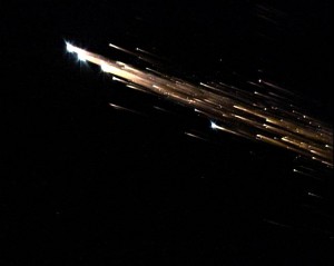
Scientists aboard NASA’s DC-8 airborne laboratory and a Gulfstream V aircraft captured the breakup and fragmentation of the European Space Agency’s Jules Verne Automated Transfer Vehicle as it reentered the atmosphere.
Photo Credit: NASA/ESA/Jessie Carpenter/Bill Moede
The DC-8, managed by NASA and operated cooperatively with the University of North Dakota, has been heavily modified with a multitude of viewports along its sides, top, and lower cargo holds. Each viewport allows scientific instruments to peer outside the aircraft through special optical windows or by using probes to collect air, moisture, particulate samples, and other data. To figure out what will go where, the scientists work closely with the DC-8 team to establish the most efficient way to install their proposed instruments and accommodate enough people to operate the equipment. With dozens of different experiments happening concurrently, the installation effort and flight-plan creation require coordination among the scientists, engineers, mission managers, navigator, and pilots.
The science teams determine before each flight where they want to go to gather data, basing projections on weather forecasts, satellite imagery, and other sources of information. Then the scientists and mission managers together create a flight plan; for example, take off from point A, then fly to points B, C, D, and so on. Once airborne, however, the team may realize point B is no longer where they thought it would be because the phenomenon of interest has moved, requiring new navigation points and altitudes.
“We have a link between the airplane and the iridium satellite system that allows us to obtain real-time updates and information on what’s most current from ground-based sources,” explained Frank Cutler, project manager for the DC-8. “You can communicate with these satellites from anywhere on the globe: North Pole, South Pole, equator, middle of nowhere. Inevitably, we receive new information that changes the entire mission in real time,” he said. The navigator on board becomes very busy helping re-plan routes with the scientists, mission managers, and pilots. During the Arctic Research of the Composition of the Troposphere from Aircraft and Satellites field campaign, or ARCTAS, locations for greenhouse gas emissions were based on atmospheric modeling. After takeoff, however, the team received model updates that required moving to new locations for collecting samples.
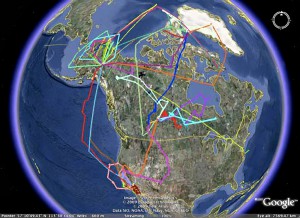
During the ARCTAS field experiment, scientists flew eighty-six research flights to gather data on the Arctic atmosphere. This Google Earth image shows the flight tracks of the three NASA airplanes that collected data on pollutants and atmospheric properties during the spring and summer of 2008.
Image Credit: NASA/L. Emmons
This flexibility in mission planning and aircraft configurability allows the DC-8 to carry out a variety of missions. ARCTAS was one of the largest missions flown aboard the aircraft in 2008. The atmospheric research, an international collaboration in support of the International Polar Year, collected data to help improve current monitoring and future predictions of Arctic change. Three of NASA’s Airborne Science Program aircraft flew the ARCTAS experiments, with the DC-8 carrying twenty-one scientific instruments and flying 184 hours across twenty-two sorties, including flights to Alaska and Greenland. The entire effort involved more than three hundred people from eight NASA centers, twelve universities, three government labs, and several other organizations.
With the airborne laboratory packed with instrumentation to study pollutants for ARCTAS, the team realized they had a unique opportunity for the California Air Resources Board to study the local air as well. Over the course of two weeks, the aircraft made several flights over California, measuring pollutants inland and offshore. Using both the DC-8 and Airborne Science Program’s P-3B, the board was able to broadly cover California during a short time and learn more about how pollution forms over the state, where it comes from, and what its sources are.
The DC-8 can do more than help study our atmosphere. Its capabilities have been used for archaeology, ecology, geography, volcanology, soil science, biology, and other Earth sciences. The Arctic Mechanisms of Interaction between Surface and Atmosphere (AMISA) mission, for example, studied the effects of global warming on Arctic ice formation. A collaboration between the University of Colorado, the National Oceanic and Atmospheric Administration, the University of Leeds, the University of Stockholm, Goddard Space Flight Center, and the University of North Dakota, AMISA packed the plane with instruments to detect sea-ice surface characteristics and atmospheric processes.
The flying laboratory has also been used to aid studies above the atmosphere. In November 2008, NASA partnered with the European Space Agency (ESA) to track reentry of a space vehicle. “ESA’s ATV-1, a cargo ship on the International Space Station for six months, had completed its mission and was made to be destroyed on reentry, not recovered,” Cutler said. “The European engineers had made predictions on how it would break up when it hit the atmosphere, and they wanted us to help them document it.”
Traveling 1,200 nautical miles south of Tahiti, the DC-8 team communicated in real time with Europe. “ESA let us know where and when ATV-1 was reentering based on its deorbit burn,” explained Cutler. As a result, an international team of scientists was able to photograph the ship’s breakup upon reentry and confirm ESA’s predictions.
Coordination and cooperation for each of these missions is key, not only between scientists, engineers, and pilots, but also between international partners and locations. “People from all over the world support these science endeavors,” Cutler said. Each mission usually contains a mix of U.S. citizens and foreign nationals, and campaigns overseas add another level of complexity to the planning. “Inevitably, we’re flying into someone else’s airspace,” explained Cutler. “We have to make arrangements with foreign governments to collect science data over their countries, fly in their airspace, and land at their airfields. It can take three months to prepare for an international deployment,” he said.
That coordination usually begins with NASA Headquarters’ Office of External Relations, which has contacts with embassies around the world. “We consult with them whenever we want to travel internationally,” Cutler said. “They help us contact the embassies, which in turn help us get permission from their governments to operate in their airspace and countries.” Obtaining that permission often requires explaining the mission science, the type of instruments that will be flown, and the team that will be aboard the aircraft, including foreign nationals and their countries of origin. “After communicating that information, the various governments are very cooperative,” explained Cutler, adding, “It also helps if our science objectives correspond with what their own government agencies and universities are studying.”
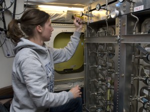
Katrine Gorham of the University of California, Irvine, operates the Whole Air Sampler inside NASA’s DC-8 research aircraft during a flight on April 12, 2008.
Photo Credit: NASA/Eric James
Research can also be done right at home with the aircraft. Early in 2009, Glenn Research Center and Langley Research Center used the DC-8 as a test bed for manmade fuels created from coal and natural gas. The plane remained on the ground as the collaborating centers tested emissions from the engines and compared them with previously recorded measurements they had from the aircraft.
The Earth-science possibilities seem nearly endless, as do the educational ones. In July 2009, the National Suborbital Education and Research Center orchestrated the Airborne Student Research Program. The first of its kind, the program offered advanced undergraduates and recent graduates an opportunity to conduct airborne science experiments. Students took air samples from various locations and altitudes over California to study chemical content and learn how large dairy operations affect the local atmosphere. They also gathered data about algae in Monterey Bay using spectral imaging. Back on the ground, students will be learning how to analyze the data they obtained and how the information applies to current and future studies.
The University of North Dakota helps communicate the educational and scientific opportunities available with the DC-8, and word of mouth from those who have flown helps keep the aircraft busy with experiments. Additionally, the Science Mission Directorate has an annual proposal process outlining various NASA resources, including the DC-8, and reviews the proposals for potential future missions. Scientists can also submit flight requests online through the Airborne Science Program Web site.
Missions can be long and exhausting, lasting eight to ten hours a day for several days, but they are worth it for the science and teamwork obtained. “Imagine flying to Europe every other day,” Cutler said when describing the experience, “but the time goes by quickly because you’re constantly updating the mission plan and concentrating on getting the job done.” After many missions during the past twenty-two years, the DC-8 team has the coordination down to an art. In the next year, they will continue their efforts with operation ICE Bridge, which took off October 12 to initially study the changing conditions of Antarctic glacial and sea ice, and will participate in the Genesis and Rapid Intensification Processes mission to study how Atlantic tropical storms form and develop into major hurricanes. They are also in discussions about helping recover and document reentry of the Japanese Hayabusa spacecraft, slated to return June 2010 with the world’s first asteroid sample.


